Share

Walking, Hiking & Trail Running

Yukon | Hiking On The Frontline Of Climate Change

Seeing the effects of rising global temperatures on a wild journey through northwest Canada

Featured Images by Tristan Kennedy

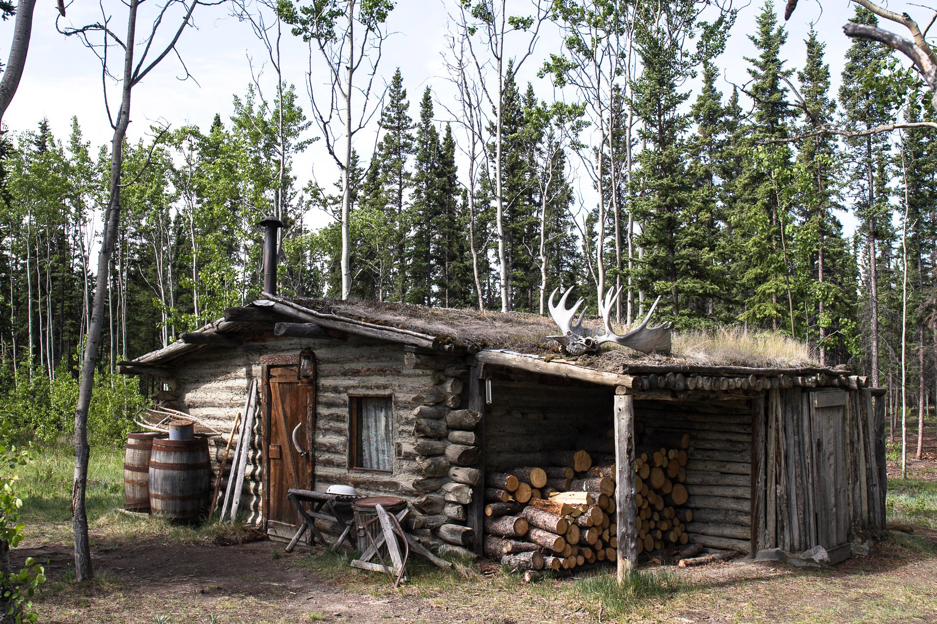
In the cult 1980s American strip cartoon, Calvin and Hobbes, there’s an extended story arc which sees six-year-old Calvin and his stuffed tiger attempt to “secede” from their family, and run away forever. Their choice of destination? Yukon. It’s a place where, Calvin dreams, they’ll be able to live wild, befriend timber wolves, and never have to clean their room again. They never make it, of course. Just twenty minutes from home, the carefully-plotted expedition falls apart when Hobbes mutinously steals ‘the commander hat’, and tries to eat their last sandwich. But having succeeded where they failed, and made it as far as Yukon’s Kluane National Park, it’s easy to see why Calvin (and his creator, cartoonist Bill Watterson) would chose this as the place to come in search of unbridled freedom.

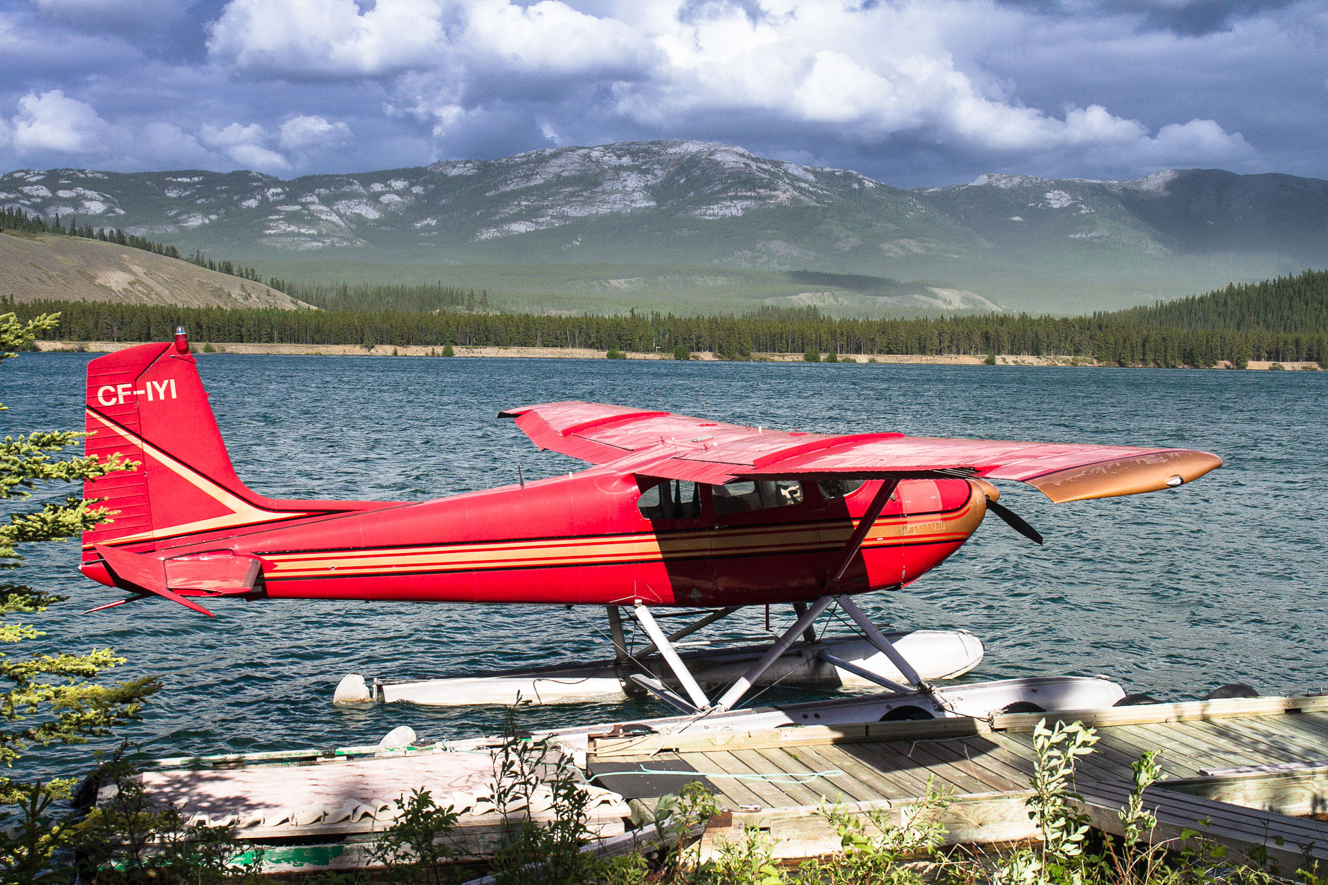
“About 37,000 people currently call Yukon home – that’s roughly one-quarter of the population of Slough, living in an area the size of Spain”

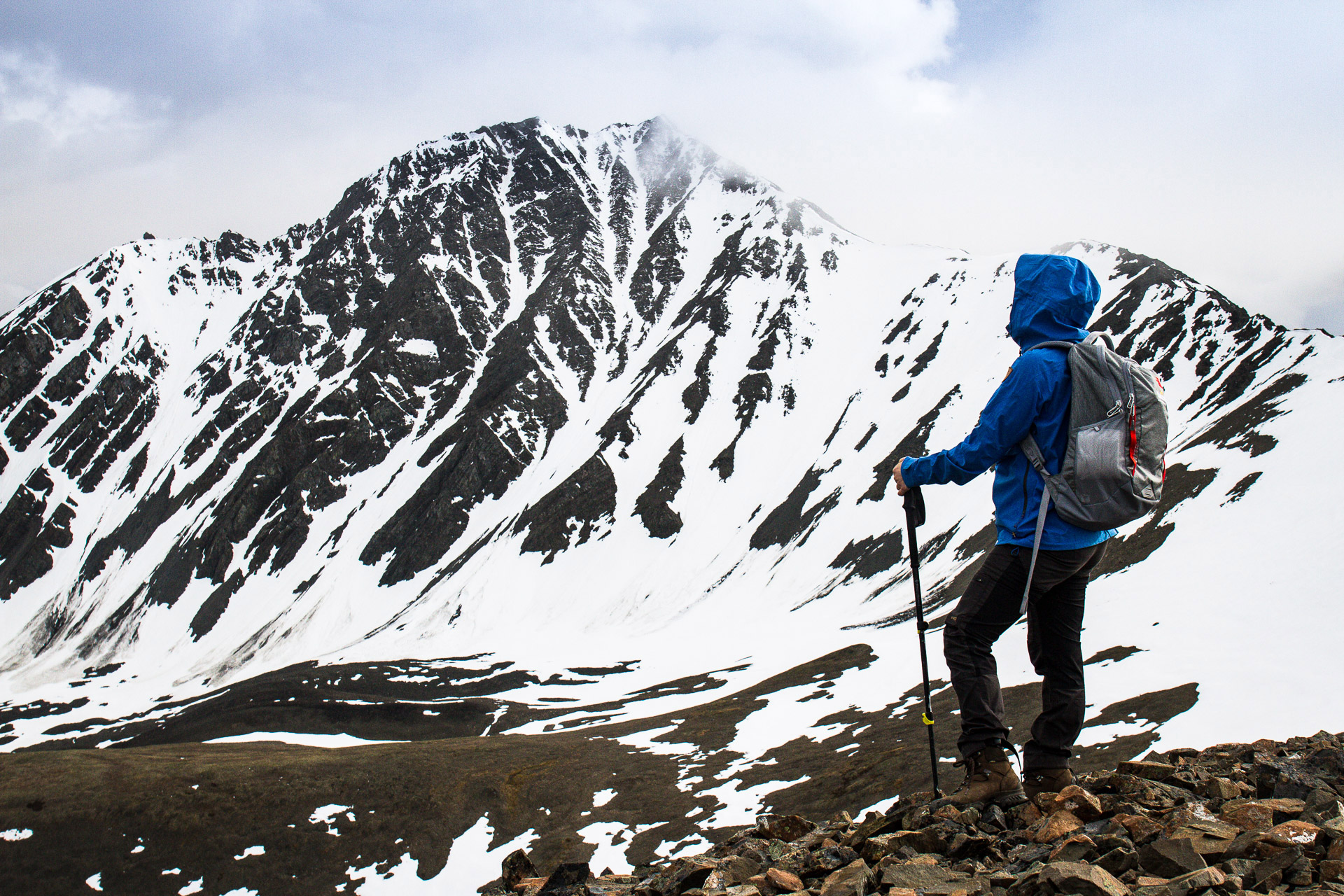
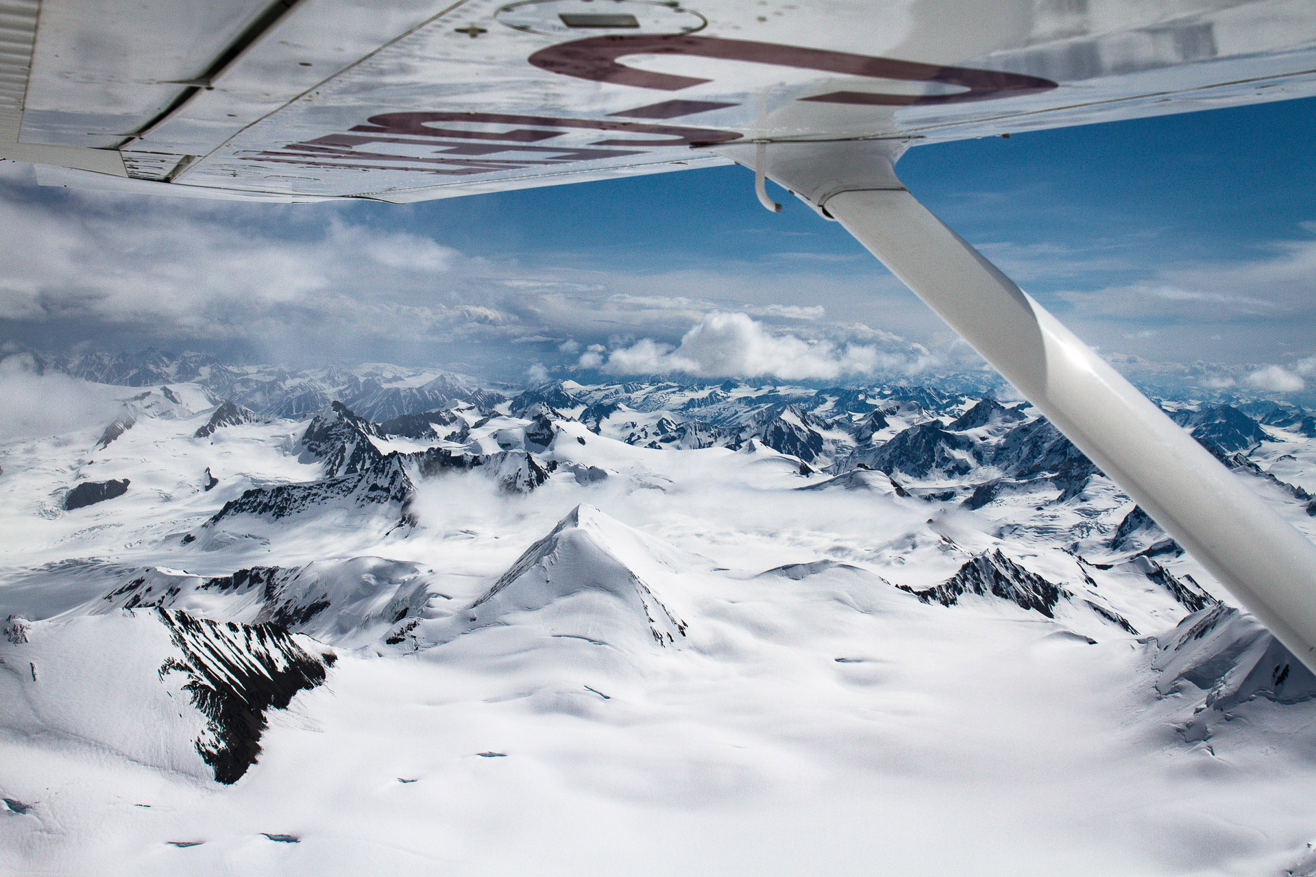
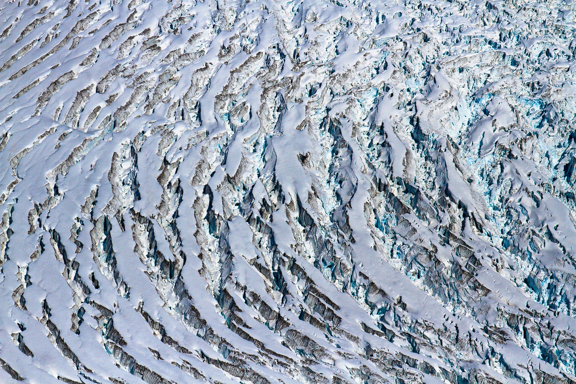
From our 1,990m-high vantage point at the top of King’s Throne peak, the visible landscape is almost inconceivably vast. On one side, snow-capped peaks jostle for position, each ridge higher and more jagged than the last. Below us lies Kathleen Lake, and the cluster of tents we’ve climbed up from. Follow the road north from there and you can just about make out Haines Junction (population 613), but beyond that there’s… nothing. Just endless miles of virgin, boreal forest, stretching as far as the eye can see, broken only occasionally by a rocky ridgeline, a marshy clearing, or the glacial blue of a meltwater river.  

Credit: Tristan Kennedy

Yukon is nothing if not remote. The territory covers a huge swathe of Canada between the top of British Columbia and the Arctic Ocean. It’s on the same latitude as Alaska, with which it shares its western border. But when it comes to people, the “final frontier” of America looks like a bustling metropolis in comparison. According to Jessica Ruffen, who works for the local tourist authority, about 37,000 people currently call Yukon home – that’s roughly one-quarter of the population of Slough, living in an area the size of Spain. 

This, of course, makes the territory a hiker’s paradise. The Kluane National Park joins onto the Tatshenshini-Alsek Provincial Park in British Columbia, the Wrangell-St Elias National Park, and the Glacier Bay National Park (both in Alaska), to make up the largest protected area in North America, covering nearly 98,000 square kilometres. (South Africa’s Kruger National Park, by comparison, covers just 20,000 square kilometres). Declared a UNESCO World Heritage site in 1994, this massive wilderness is also home to the biggest ice-field outside the polar regions. But it’s a landscape that’s changing, and changing rapidly, in ways that neither its UNESCO designation nor its protected status can prevent.

“Statistics show that average temperatures have risen by 2 degrees in the last 50 years, and winter temperatures by 4 degrees”

Global warming becomes more pronounced the further north you travel. As Dr. Henry Penn, science and sustainability manager of the Arctic Institute of North America’s Kluane Lake Research Station explains: “Two degrees at the equator is basically five degrees at the poles”.

While the rest of the world is trying to limit warming to 1.5 degrees celsius, Yukon is way past that threshold. Local government statistics show that average temperatures have risen by 2 degrees in the last 50 years, and winter temperatures by 4 degrees – increasing at more than twice the rate of southern Canada. The knock-on effects these changes are having on landscapes and livelihoods are becoming increasingly serious, and increasingly visible, even to visitors.

Credit: Tristan Kennedy

None of this is instantly obvious when you land in Whitehorse, however. In fact, what’s interesting is how little the territorial capital seems to have changed down the years. All but a few thousand of Yukon’s people live here. But what they call “the city” still feels like a sleepy frontier settlement. Fly fishermen perform languid casts in the stretch of river that runs through the city centre, every second car is a farm-sized pick-up and just outside town, a handful of floatplanes bob gently against homemade jetties.

“There are really only three major moments in Yukon’s history that involve people,” Jessica Ruffen explains. “The Pleistocene era, when the ancestors of the First Nations walked across the land bridge connecting Asia with Alaska; the Klondike Gold Rush of the late 1890s, when hopeful prospectors ‘stampeded’ up to Dawson City; and then the building of the Alaska highway by American GIs in the 1940s.” In between, this land was left largely alone. 

“From the air, the empty A’ay Chu riverbed is now a scar in the landscape”

Driving the Alaska Highway features on many American and Canadian bucket lists, at least if the number of rented RVs is anything to go by. Tourism numbers in Yukon remain small, but they’re increasing steadily, with the bulk of the growth fuelled by this main artery. It’s certainly prime road trip country – the scenery is stunning, and the highway is blissfully empty. The only time we encounter anything that could conceivably be called traffic is when two other cars pull up alongside us, to watch a black bear and her three cubs gambolling by the side of the road. 

Credit: Tristan Kennedy

It’s one thing encountering bears from behind the protective shield of a windscreen of course, and quite another thinking about meeting one in the flesh. I’m well used to hiking, camping, and cooking outdoors, but I’m not ashamed to admit that the thought of doing it in bear country has made me nervous ever since we set off from the UK.

The leaflets laying out the complicated rules about when to play dead and when to fight back if attacked have done nothing to assuage this fear, nor has the ‘reassuring’ chat from the guy who sold us bear spray in the camping shop. Identifying whether a bear is merely curious, or wants to “make a meal of you” seemingly depends on which way its ears are pointing. This is all very well in theory. But having seen ferocious-looking stuffed grizzlies up close in Whitehorse’s museum, I can’t help thinking that in real life their razor sharp teeth and claws might prove something of a distraction from the business of observing the ears. 

Thankfully, we never have a chance to put theory into practise. Perhaps this is because we follow Parks Canada’s precautions to the letter – cooking downwind and well away from the tent, storing food, and anything else remotely smelly, in a bear-proof canister, and singing lustily while walking, so bears can hear us coming. Or perhaps it’s because, despite spending several days in the Kluane National Park, we’re still very much just skirting the edges.

When we were plotting our walking routes, we knew we’d be confined to ‘the front range’. But it isn’t until we jump into a tiny Cessna, flown by Kluane Glacier Tours that we realise just how little of the park we’ve seen.

“It’s an area the size of Switzerland,” says Stuart, one of Glacier Tours’ pilots. As we bump down the airstrip and up into the air we get the most incredible views – not just back over the paths we’ve been hiking, but out over the Kluane ice-field itself.

“In 2017, a river that had existed for thousands of years disappeared almost literally overnight.”

Glance at a map and you’d be forgiven for thinking that this was just an enormous expanse of white, punctuated by the occasional rocky peak. From the windows of a small plane however, the contours, crevasses, and even the character of the ice becomes apparent. Glaciers are usually thought of as inert, static, immobile. But the swirling cracks and violent-looking ruptures in the ice tell a different story. This is a landscape that’s powerfully alive, and constantly on the move.

Pictured: Kaskawulsh. Credit: Tristan Kennedy
Pictured: Kaskawulsh glacier retreat. Credit: Tristan Kennedy
Credit: Tristan Kennedy

Recently, however, the speed of these movements has become frightening. In 2017, a river that had existed for thousands of years disappeared in the space of just four days.

In a striking example of what climate scientists refer to as a “tipping point”, the Kaskawulsh glacier receded so far that the meltwater feeding the A’ay Chu river began flowing down a different valley. From the air, the empty riverbed is a now drying, scabbing, scar in the landscape. It’s on the ground however that the real ravages of this change become apparent. 

We spend our last evening in Yukon as guests of Dr. Henry Penn and his colleagues, whose Arctic Institute research station sits on a lake that, until 2017, was fed by the A’ay Chu. Dr. Matt Ayre, a historical climatologist and keen outdoorsman, drives with us out to the dry riverbed. “They have to send a snow plough down this section of highway in summer now, because of the that dust gets blown onto the road,” he says. “At one point the dust storm was so intense, the plough drove off the side of the road.”

“Basically a huge flash flood called – it’s an Icelandic term – a jökulhlaup”

Back at the station, Henry talks me through some of the research projects his scientists have conducted into the long-term effects. The dust now coats plants, contaminating the entire food chain. The water level of the lake is sinking, and will probably eventually settle at “around 12 feet below where it once was”, he says, and these changes will affect the entire ecosystem, including “fish populations, salmon spawning areas,” and potentially much more.

It’s not just animals who will suffer either. On the northern side of the lake sits Burwash Landing, home to the Kluane First Nation, one of the indigenous ethnic groups who’ve lived on these lands for centuries. “All of their boat launches, all of the access points, have been lost,” says Henry.

Credit: Tristan Kennedy

As dramatic as the missing river is, it’s far from the only visible effect of climate change in Kluane. As research station manager, Henry’s right hand man is Bob. He’s the head chef and a long-term Yukon resident, who cooks up a storm, smokes like a chimney, and merrily rips the piss out of anyone in firing range. “I usually put about 2,000km on my snowmobile each winter,” he tells me, “but last year I only did 300. There just isn’t enough snow. I didn’t have to shovel my driveway once last winter.”

Over one of Bob’s excellent lunches, I get talking to Professor Brian Moorman, a glaciologist from the University of Calgary’s department of Geography and Geosciences. He explains how “ice-dammed lakes” can form as glaciers melt, and then burst their banks. “You can get 2km, 3km lakes, that drain in a matter of two days,” he says. “Basically a huge flash flood called – it’s an Icelandic term – a jökulhlaup.” 

This talk of the climate changing at apocalyptic speeds might sound like Ragnorök is just around the corner. But it’s not all bleak up here in the far north. Yukon’s government has an unusually progressive relationship with its First Nations inhabitants, having become the first territorial administration to settle the thorny issue of land claims. The Kluane National Park is a shining example of how the policy benefits local people. It’s now co-managed by the federal government, the Kluane First Nation and the Champagne-Aishihik First Nation, a situation that Tom Buzzell, Parks Canada’s First Nation Liaison officer and himself a member of the Champagne-Aishihik, describes as “very progressive”.

Credit: Tristan Kennedy

The agreement means indigenous people have greater rights over the park, better access to Parks Canada jobs, and fairer representation on key governing bodies. But it also means that the knowledge they’ve passed down through generations – about fish and game breeding patterns, climatic conditions, and how to manage this land sustainably – is now being utilised. This is a goldmine for scientists like Professor Moorman. As he explains, numerical data about the climate is useful, but that only goes back around 50 years. The First Nations’ oral history spans centuries.

The tragic fact is, of course, that while the people who live are acutely aware of the dangers they face, the fate of their lakes, forests and glaciers isn’t really in their hands. What happens to the Yukon will be decided by policies put in place in far-away capitals, primarily by people that locals here haven’t voted for.

If the world sticks to its commitments under the Paris Agreement, there’s a chance that Yukon will remain a byword for pristine wilderness, as it was when Calvin and Hobbes struck out here in the 1980s. But even if the worst is avoided, this landscape has already been radically altered, and more change is undoubtedly coming. Given what’s happened so far, it’s hard to be optimistic. As Brian Moorman says, “when people ask if you’re a glass-half-full or a glass-half-empty kind of guy, I say I’m a scientist: The glass is completely full – half full of water, and half full of air.” 

Tristan’s trip was supported by Travel Yukon.

You May Also Like

Carbon Offsetting | Solving The Awkward Dilemma of the Climate-Conscious Traveller

Making a Splash | The Urban ‘Mermaid’ Who Swam 120 Miles Down the River Thames

Share

Newsletter Terms & Conditions

Please enter your email so we can keep you updated with news, features and the latest offers. If you are not interested you can unsubscribe at any time. We will never sell your data and you'll only get messages from us and our partners whose products and services we think you'll enjoy.

Read our full Privacy Policy as well as Terms & Conditions.

production