Share

Walking, Hiking & Trail Running

Best Hikes In France | Top 10

From the seaside to the Alps, here are the most spectacular walks in France

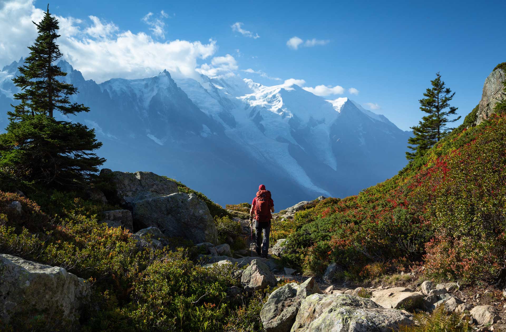
A hiker’s paradise, France is a country with over 60,000kms of GR (Grand Randonnée) routes. The country is criss-crossed with trails, from hour-long plods to multi-month adventures. With the Alps to the east, the Pyrénées to the south, a vast coastline and the extinct volcanoes of the Auvergne slap-bang in the middle, hiking in France is nothing if not varied.

Whilst the trails here could keep you going for a lifetime rather than just a season, we can’t help but have our favourites. Here’s our top 10.

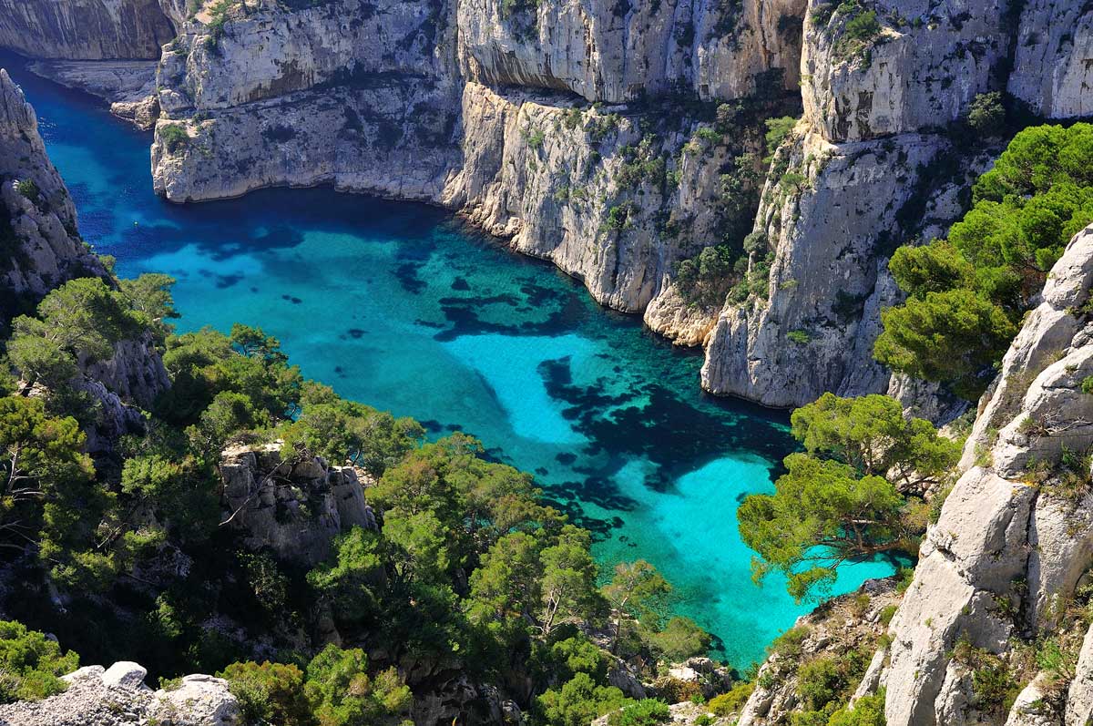
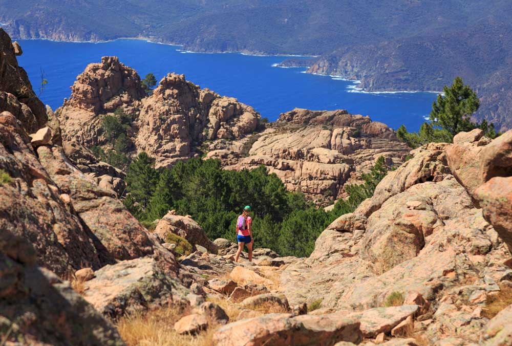
The GR 20, Corsica Regional Park

Corsica is home to challenging walks. Photo: Getty Images

Start: Calenzana

Finish: Conca

Length: 180 km /110 miles

Time: 12-16 days

Often lauded as Europe’s toughest trek, the GR 20 challenges even the hardiest of hikers. Scrambling, near-vertical drops and knee-shattering descents are the rule rather than the exception on this trail. 

Most hikers choose to walk north to south, tackling the hardest part of the trail first. Vizzavona, a train station just over halfway, serves as a handy transit point and refuel station, and allows time-poor hikers to choose to split the trail into two halves. 

The northern part of the trail is characterised by barren, jagged peaks and steep scree slopes, before softening in the south to forests, rivers and pools, perfect for a dip during the hot summer months, where daytime temperatures are regularly in the 30s. 

From mid-June to late September, refuges and bergeries (shepherd’s huts) are open and sell three-course meals, fresh cheeses and Pietra (Corsican beer), although costs can be at a premium. Out of season you’ll have to be largely self-sufficient. 

Up to 20,000 hikers tackle the GR20 each year, and the vast majority do so in the summer months, so booking refuges or camp spots is recommended. Wild camping away from refuges is not permitted. 

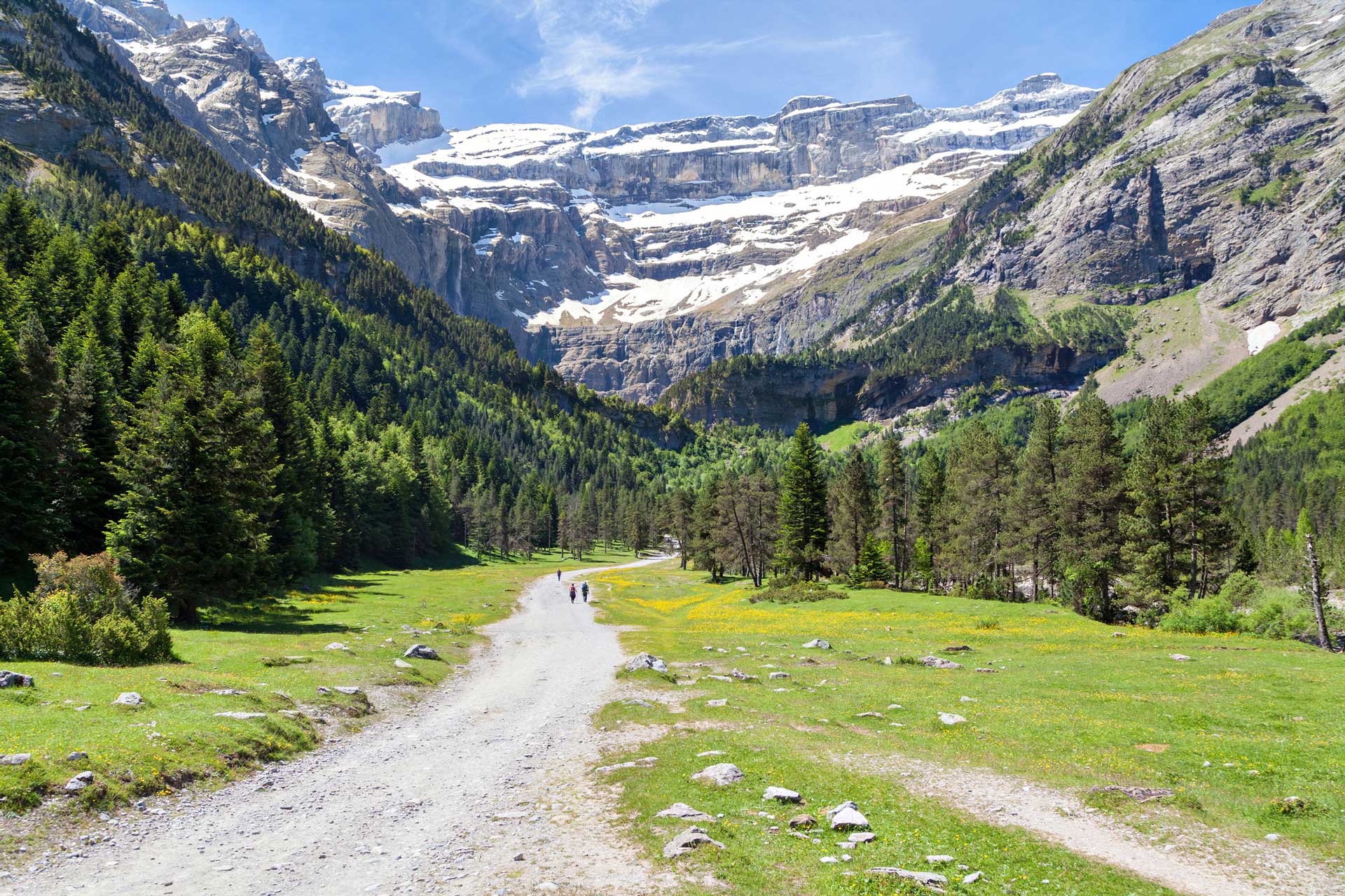
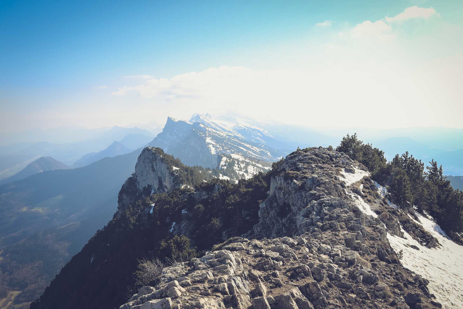
Cirque de Saint-Même, Chartreuse Regional Park

Start/Finish: Saint-Pierre-d’Entremont

Distance: 10 km /6 miles

Time: 2-3 hours

This relatively easy trail rewards minimal efforts with maximum views, serving up four different waterfalls that pour down from the steep cliff faces of Chartreuse National Park. We’ve included a 10 kilometre walk, but this trail can easily be shortened or lengthened.

For a shorter walk, keep driving to Saint-Pierre-d’Entremont until you reach a car park just a couple of hundred metres before the first waterfall. Alternatively, extend your hike by taking the path which climbs steeply to the left after the final waterfall to pass by Pas de la Mort (adding on roughly three hours). 

During the summer, the waterfalls get very busy with picnickers and tripod-wielding tourists, and although the pine forests provide welcome shade, the pools are perfect for a refreshing dip. In the winter, the cascading water freezes to form spectacular ice waterfalls and the trail is much quieter. Although this is a very accessible trail, sections of the path are steep, rocky, and often wet and slippery next to the falls. 

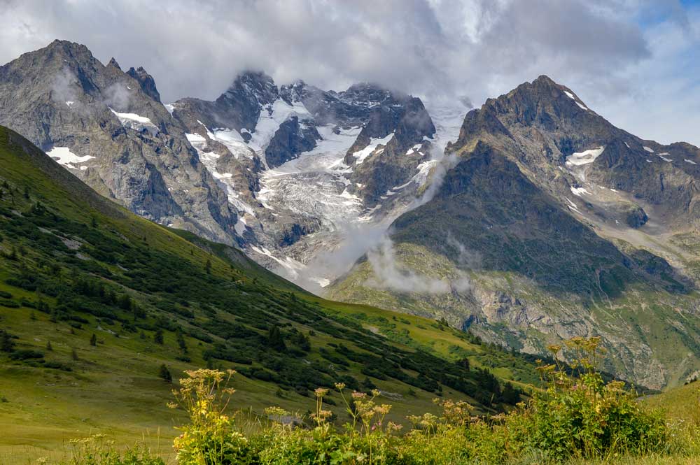
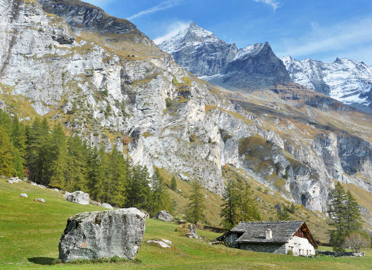
The GR 54 (Grand Tour des Écrins), Écrins National Park

Le Bourg-d’Oisans is where the GR 54 loop starts and ends. Photo: Getty Images

Start/Finish: Le Bourg-d’Oisans (loop)

Distance: 176 km / 109 miles

Time: 7-14 days (average 10 days)

With a reputation for being amongst the most challenging GR routes in France, the GR 54 is not for the faint-hearted. The views, however, are worth the effort and it attracts far fewer tourists than better-known trails such as the GR 20 and the Tour du Mont Blanc. 

The trail starts in Le Bourg-d’Oisans and trekkers following the full GR 54 will return to their start point. For the time-poor, a six-day route covers the southern section of the trail, which is widely considered to be the most dramatic. 

The scenery in Écrins is rugged, wild, and exceedingly varied. There’s little flat ground with 14 mountain passes to be crossed and roughly 12,000m of elevation gain. Highlights include waterfalls, mountain lakes, scree and jagged peaks, and even glaciers. Wild camping is permitted, and there are also refuges throughout the route. 

The GR 34 (Coastal Path), Brittany

The iconic Mont-Saint-Michel. Photo: Getty Images

Start: Mont Saint-Michel

Finish: Saint-Nazaire, Loire-Atlantique

Distance: Approx. 2,000 km / approx. 1,250 miles

Time: 3-5 months

Brittany’s salt path, unlike the British equivalent, dips inland at intervals rather than hugging the coast the whole way. The views are no less spectacular, as would be expected of a trail which starts somewhere as iconic as Mont Saint-Michel. Buttercup-coloured gorse contrasts with turquoise waters, long, sandy beaches and rocky cliffs dotted with lighthouses. 

To walk the entire trail you’ll need several months, so many people take on smaller sections at a time. We particularly recommend the Crozon Peninsula for a long weekend (it takes four days, and is approximately 88 kilometres in length). 

Brittany has a mild climate, so this trail is accessible all year round, but rainfall is frequent and good waterproofs are a must. Wild camping is permitted (and there are ample spots to pitch a tent), but the trail is also well-equipped with campsites, gites and B&Bs, and eateries are plentiful and bountiful. After all, it would be a shame to hike through Brittany without sampling the rich gastronomy of cider, galettes and moules marinières!

Juliénas Loop, Beaujolais

Welcome to wine country. Photo: Getty Images

Start/Finish: Juliénas

Distance: 18 km / 11 miles

Time: 4-5 hours

If leisurely pottering from vineyard to vineyard is more your scene, look no further than the Juliénas Loop; a half-day hike which combines two of life’s great pleasures – walking and wine. 

Beaujolais is largely characterised by undulating hills, so whilst the ascents and descents are rarely too taxing, you’ll gain more elevation than you’d expect. That being said, the gentle paths mean that it’s perfectly possible to stop at the numerous vineyards and wine cellars en route to taste the finest crus of the Beaujolais region. 

This trail is particularly spectacular in autumn when the leaves are turning red and the wine harvest is in full swing. 

Crêt de la Neige and Reculet, Jura Regional Park

Jura Regional Park is often described as France’s last true wilderness. Photo: Getty Images

Start/Finish: Lélex

Distance: 20 km / 12 miles 

Time: 5-7 hours 

Jura Regional Park is often described as France’s last true wilderness, and whilst the mountain peaks are lower than in neighbouring alpine parks, it’s a fantastic spot for hiking away from the crowds, without compromising on views. 

“Jura Regional Park is often described as France’s last true wilderness”

Park at Lélex, a small mountain town and winter ski resort, and take the trail which climbs steadily for a couple of hours to reach the Crêt de la Neige (Snowy Summit). It’s the highest peak in the Jura Massif. True to its name, it’s often snow-covered by mid-autumn. From here the trail follows the ridge to Reculet (clearly visible on the horizon and marked with a large, wooden cross), with panoramic views over Geneva and the Swiss Alps the whole way. The descent is a knee-jerker, stony and very steep. 

Jura is known for having some of the best cheese in France, so we recommend bringing fuel for the climb in the form of Morbier and Comté. 

Cirque de Gavarnie, Hautes-Pyrénées

The Cirque de Gavarnie is one of France’s most well-known day walks. Photo: Getty Images

Start/Finish: Gavarnie

Distance: 11 km / 7 miles

Time: 3-4 hours

The Cirque de Gavarnie is one of the best-known day-hikes in the country, and justifiably so. It offers views of 3,000m peaks, and leads straight to one of the largest waterfalls in the whole of Europe. 

We’ve recommended a half-day trail, but it’s perfectly possible to shorten or lengthen the route as the Pyrénées around Gavarnie are littered with hiking trails. A UNESCO world heritage site, the diverse flora and fauna in Gavarnie have been studied by botanists, scientists and poets alike. Victor Hugo reportedly described the falls as a ‘colosseum of nature’. 

The landscape is lush and verdant, and there’s often still snow on the highest mountain peaks at the start of the summer, making for a beautiful contrast with the green below.

Les Calanques de Cassis, Bouches-du-Rhône

The famous inlet of En Vau. Photo: Getty Images

Start/Finish: Cassis

Distance: 13 km / 8 miles

Time: 3-4 hours 

The Calanques are steep, rocky limestone cliffs which stretch for some 20 kms between Marseille and Cassis. Plunging steeply to meet turquoise fjords and inlets, as well as sand and pebble beaches, it’s a paradise on earth for snorkelers and kayakers. The busiest of the Calanques are those closest to Marseille, so we recommend starting from Cassis, a small fishing town famed for wine production (and a welcome spot for an apéro after a day of hiking in the sun).  

From Cassis, pass two ports and the little inlet of En Vau, where wild boars regularly patrol the beach. Don’t be tempted to feed them! Although pine trees provide sporadic shade, Southern France gets extremely hot in the summer, so swimwear is a must (it will be hard to resist that crystal clear water). 

Tour du Mont Pourri, Vanoise National Park

The scenery in the Vanoise National Park is something special. Photo: Getty Images

Start/Finish: Arc 2000

Distance: 47 km / 29 miles

Time: 4 days

It’s difficult to beat the Tour du Mont Pourri in terms of the variety of views offered in a short timeframe. This trail takes you to the second-highest peak in Vanoise National Park. Very fit hikers can complete the trail in just two days, although it’s typically covered in four days/three nights. Refuges conveniently located throughout the route make for a (relatively) comfortable night’s sleep. 

The trail is largely well-marked, and not overly crowded, winding through verdant valleys and past waterfalls and glaciers, with superb views of Mont Blanc from the summit. Mont Pourri itself is over 3,700m high and snow-covered for much of the year, so some mountaineering experience is recommended. If attempting outside of the summer months, an ice axe and crampons are a must. 

Le Moucherotte, Vercors Regional Park

Le Moucherotte is an accessible day hike near Grenoble. Photo: Jametlene Reskp

Start/Finish: Lans-en-Vercors

Distance: 12 km / 7 miles

Time: 3-4 hours

Just half an hour’s drive from Grenoble, Le Moucherotte is an accessible day hike which still leaves trekkers feeling as though they’ve escaped from civilisation. The pretty little town of Lans-en-Vercors is a low altitude ski resort during the winter with ample parking and restaurants for refuelling after your stomp. 

The steepest part of the trail is right at the start, before levelling out and widening for the final section. It’s a well-marked route with views over craggy rock faces, green valleys and little villages crowned with church spires. 

At Le Moucherotte, the urban metropolis of Grenoble sprawls below you, framed by the Alps. Due to its proximity to the city, the summit is often crowded on weekends and sunny days.

You May Also Like

Walking Books | 5 of the Best

Best Long-Distance Walks In Snowdonia

Why There’s Nothing Quite Like Golden Hour Hiking In The French Alps

Newsletter Terms & Conditions

Please enter your email so we can keep you updated with news, features and the latest offers. If you are not interested you can unsubscribe at any time. We will never sell your data and you'll only get messages from us and our partners whose products and services we think you'll enjoy.

Read our full Privacy Policy as well as Terms & Conditions.

production