Share

Walking, Hiking & Trail Running

5 Trail Running Routes in Snowdonia | The Top Trails For Off-Road Runners In North Wales

With its spectacular landscapes, richly varied terrain and sprawling network of tracks and trails, Snowdonia is the ideal destination for trail runners. So, if you love putting in the miles amidst stunning surroundings, grab your trail running shoes and head for North Wales…

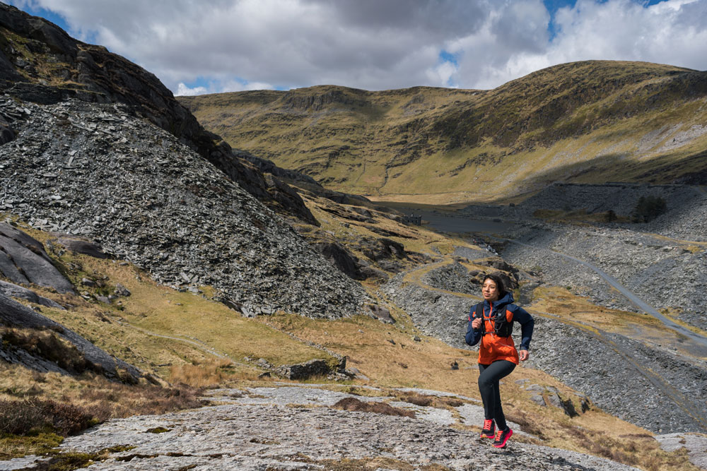
Snowdonia has long been a mecca for climbers and hillwalkers, but it also boasts some spectacular trail running routes – including the iconic Paddy Buckley Round, one of the UK’s ‘Big Three’ fell running challenges. Completing the full round means covering 61 miles and climbing 47 peaks, with around 28,000ft of total ascent. In April this year, former British Trail Running champion Kim Collison completed the route in an impressive 16 hours and 20 minutes. But even if you’re not quite up to a challenge of that magnitude, there are plenty of scenic off-road routes within the national park that can be completed in a couple of hours or a full day – without needing to run at record-setting pace.

Credit: Chris Johnson

By way of example, we’ve picked out our top five trail runs that showcase the spectacular landscapes of North Wales. Ranging from circular lakeside trails to exhilarating ridge routes, there ought to be a run here to suit all abilities, whether you’re looking for a quick morning sharpener or a more challenging high-level mountain route that will really test your endurance – and your calf muscles.

1) Precipice Route, Mawddach Estuary

Distance: 3.6 miles (5.8 km)
Elevation:
270m (886 ft)
Difficulty:
Easy
Start / Finish:
SNPA Car Park, Saith Groesffordd, Llanfachreth (Grid Ref SH 746 212 / Sat Nav postcode LL40 2NG)

LL40 2NG)

This scenic circular trail near Dolgellau offers spectacular views of the Mawddach Estuary and far-reaching vistas of some of Snowdonia’s central and southern mountain ranges, including the Snowdon massif, the Moelwynion, the Rhinogydd and Cader Idris. It’s a short and easy route that heads out through broadleaf woodland and conifer plantation before contouring around the shoulders of two minor peaks, Foel Cynwch and Foel Faner.

“Genuinely jaw-dropping panoramas”

The return takes you through upland meadows and along a lake shore, which all form part of the sprawling, privately-owned Nannau estate. The ‘precipice’ section of the route isn’t as vertiginous as it sounds, and largely sticks to the 250m contour line, so the elevation is gentle and undulating. This makes it an ideal circuit if you’re looking for a relaxed 5k to get the legs working – but it’s also one with genuinely jaw-dropping panoramas.

2) Cwm Bychan and Aberglasyn from Beddgelert

Distance: 6 miles (10 km)
Elevation:
420m (1380 ft)
Difficulty:
Moderate
Start / Finish:
Beddgelert (Grid Ref SH 588 481 / Sat Nav postcode LL55 4YJ

This varied 10km circuit starts from the picture-postcard village of Beddgelert, situated at the confluence of two rivers – the Afon Glaslyn and Afon Colwyn. The village has plenty of parking and a wealth of amenities, including a famous ice cream parlour and four excellent pubs (ideal post-run R&R). Essentially, this route skirts the foothills of Mynydd Sygyn, a minor peak that rises above Beddgelert, most famous for the historic copper mine on its northern flanks. Leaving Beddgelert, you pick up the popular riverside path along the Glasyn Gorge, known as the Fisherman’s Path, hopping from boulder to boulder beside the rushing river before heading up Cwm Bychan from Nantmor.

“One of Snowdonia’s best hidden gems”

This little valley is one of Snowdonia’s best hidden gems, punching well above its weight in terms of views to be gained for the modest amount of effort expended. You’ll see the atmospheric remains of the old copper workings here, including rusting pylons that once carried an aerial cableway. Later on, the views open out towards mighty Snowdon and Moel Siabod. As the path forks, head right to continue up the valley, before gradually descending towards Llyn Dinas. When you reach the southern end of the lake, pick up the path towards Sygun Copper Mine. Go past the entrance to the mine, following the quiet lane and the riverside footpath that leads back into Beddgelert.

3) Llyn Padarn and Llyn Peris Circuit, Llanberis

Distance: 9.5 miles (15.2 km)
Elevation:
440m (1,444 ft)
Difficulty:
Moderate
Start / Finish:
Llanberis (Grid Ref SH 578 604 / Sat Nav postcode LL55 4FA)

If you’re staying in Llanberis or nearby villages such as Nant Peris, Brynrefail or Deiniolen, this lakeside ten-miler makes for a great run that can be started pretty much from the front door of your holiday accommodation. It’s a varied and interesting circuit that takes in a real mix of terrain, with both tarmac and trail sections underfoot. There’s a little bit of up and down to get the calves working, which also means you can enjoy lofty views of Llyn Padarn and Llyn Peris below, as well as the surrounding peaks of Northern Snowdonia. Unusually, you can also run straight through the atmospheric remains of disused Dinorwic Quarry, once the second-largest slate quarry in the world.

“Run straight through the atmospheric remains of disused Dinorwic Quarry, once the second-largest slate quarry in the world”

Leave Llanberis, initially pounding pavement alongside the A4086 but soon picking up the lakeside path and cycle track through Padarn Country Park. Hug the lakeshore and pick up the old road that leads to the bridge across the Afon Rhythallt. Follow the minor road into Brynrefail, then take a footpath off to the right towards Frongoediog. This ascends a knoll and then gradually descends into Fachwen before a punishing uphill road section to reach the four-way road junction, where there’s a café and bunkhouse called The Lodge. Turn right and run along the road all the way to the turning circle and parking area, where you turn left through a kissing gate into Dinorwic quarry.

Follow the main track past the Matilda and Victoria quarries with loose slate underfoot, before descending the hillside into Nant Peris via the farm at Fron. Join the A4086 just before the Vaynol Arms and run along the shores of Llyn Peris, detouring at the remains of Dolbadarn Castle to avoid too much tarmac. This path descends to the road on the opposite side of Afon Arddu, where you turn right and then left towards the country park. Eventually you’ll end up back in Llanberis and your start point, tired but exhilarated.

4) Moel Eilio Round

Distance: 8.5 miles (13.6 km)
Elevation:
803m (2,634 ft)
Difficulty:
Moderate
Start / Finish:
Llanberis (Grid Ref SH 578 604 / Sat Nav postcode LL55 4FA)

Another route that starts from the popular tourist village of Llanberis, this belter of a run offers panoramic views in a tranquil setting, with some lung-busting climbs and rolling downhill sections that really allow you to build up some speed. It takes in the 726-metre summit of Moel Eilio as well as its two subsidiary tops, Foel Gron and Foel Goch. All three peaks boast fabulous views of the Glyderau, the Nantlle Ridge and mighty Snowdon itself, as well as the lakes of Llyn Padarn and Llyn Cwellyn nestled in the valleys on either side. Ascents aren’t particularly technical, since these hills are turfed in grass and heather rather than being too craggy, but they still get the legs working to make this feel like a proper fell run.

“This belter of a run offers panoramic views in a tranquil setting, with some lung-busting climbs and rolling downhill sections”

Leave Llanberis on the Snowdonia Slate Trail, which follows narrow streets and then a lane high up above the village. This is also part of the North Wales Pilgrim’s Way. At the end of the lane, join a track heading northwest towards Waunfawr. At Bwlch-y-groes, an obvious path leads off left, making for the summit of Moel Eilio. Follow it to the summit, then follow the up-and-down ridge to the twin tops of Foel Gron and Foel Goch. The descent from here is a steep and slippery sheep trod down into Bwlch Maesgwm. Pick up the bridleway that runs along the valley floor for about 3km back towards Llanberis.

You could follow this all the way back into the village, but alternatively, head sharp right on a track just before the bridleway crosses Afon Hwch. This track passes over the Afon Arddu, meeting a series of paths. Take the track alongside the stream, heading gradually downhill before crossing the rack-and-pinion line of the Snowdon Mountain Railway. The path meets the road that heads up to the start of the Llanberis path, the most popular route up Snowdon for first-timers. Dodge the tourists and run down the road, past falls and woodland, then go left under the railway line to bring you back into Llanberis.

5) Nantlle Ridge Linear Traverse

Distance: 9 miles (14 km)
Elevation:
962m (3,156 ft)
Difficulty:
Hard
Start / Finish:
Rhyd Ddu (Grid Ref SH570 525 / Sat Nav postcode LL54 6TN). Finish at Nebo (park at Cwm Dulyn road outside the village, Grid Ref SH483 500 / Sat Nav postcode LL54 6RT)

This classic trail snakes along the spine of one of Snowdonia’s best ridges. Unless you’re hardcore enough to tackle it as an out-and-back, it’s a point-to-point traverse, which requires some logistical planning to get from the finish point back to the start. However, this is easily achieved with the use of two cars, a pre-booked taxi or a couple of bus rides. A little word of warning: this run shouldn’t be underestimated, despite the modest mileage. It is a high-level mountain route, so you’ll need decent fell or mountain running experience. The majority of the route is over 2,000ft (600m) and is both steep and exposed, with plenty of elevation gain and some short sections of easy scrambling. Having said that, if you’re fit and experienced enough to take it on, it makes for a truly epic day in the hills.

Ready? Leave the car park at Rhyd Ddu and pick up the path north of Llyn y Gader. Turn right after the footbridge, then left at the junction with the B4418, following the bridleway uphill. Turn right onto open hillside and start climbing to the cairn that marks the summit of Y Garn, the first peak on the ridge. Follow the ridge south over Mynydd Drws-y-Coed. The crest here is steep and exposed – watch your footing. Head around to the right to reach Trum y Ddysgyl, across the col and up to Mynydd Tal-y-Mignedd, another tricky section with some hands-on scrambling.

“If you’re fit and experienced enough to take it on, it makes for a truly epic day in the hills”

From the obelisk, follow the stone wall that drops away to the south, making for Bwlch Dros-bern. The descent is steep, before climbing back up above and around Craig Pennant to the spine of the ridge. Now head southwest as the ridge broadens to the trig pillar at Garnedd-goch. Continue in the same direction, heading down off the summit direction downhill, before going left at the path junction to Bwlch Cwmdulyn.

Climb back up out of the bwlch and loop around the eastern shoulder of Mynydd Graig Goch, the final summit of the ridge. From here, find the tumbledown section of the stone wall to cross it, then follow the grassy, heathery path down to the reservoir. Turn left, away from the bridge over the river, following the fence-line before picking up a minor road back into the small village of Nebo.

**********

For more from our Wales Issue 

You May Also Like

5 of the Best Trail Running Routes In Valais

26 Running Puns That Will Have You In Stitches

Best Coastal Runs In The UK | 10 Coastline Routes To Get You Running

An Interview With Finlay Wild | The Record Smashing Scotsman

Share

Newsletter Terms & Conditions

Please enter your email so we can keep you updated with news, features and the latest offers. If you are not interested you can unsubscribe at any time. We will never sell your data and you'll only get messages from us and our partners whose products and services we think you'll enjoy.

Read our full Privacy Policy as well as Terms & Conditions.

production